


Back
BUSINESS > CONFERENCE & BUSINESS EVENTS >

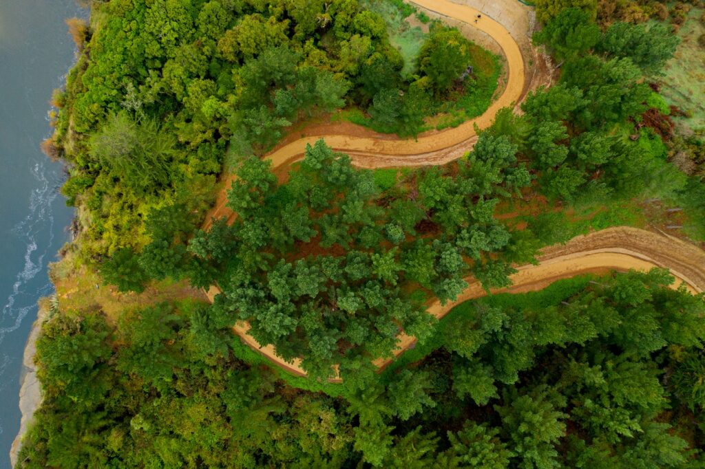
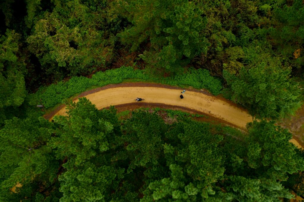
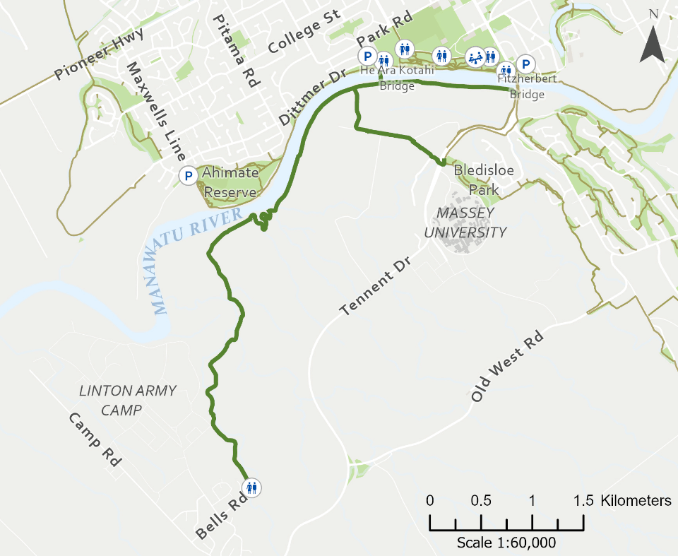
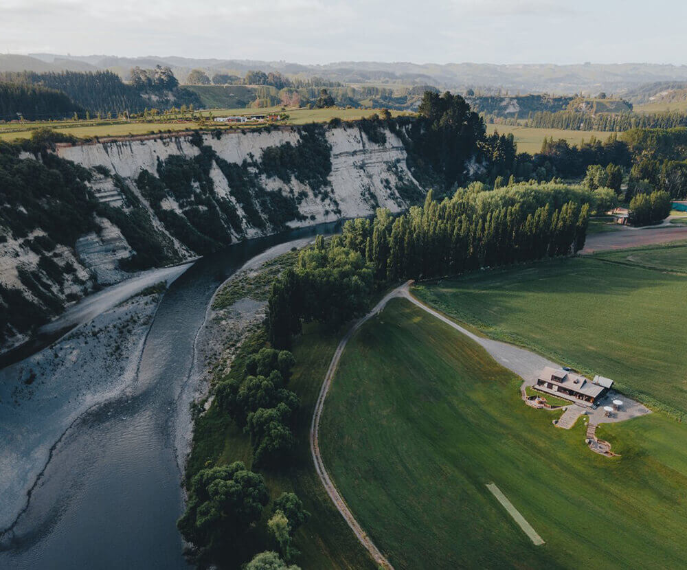
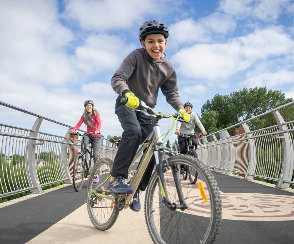
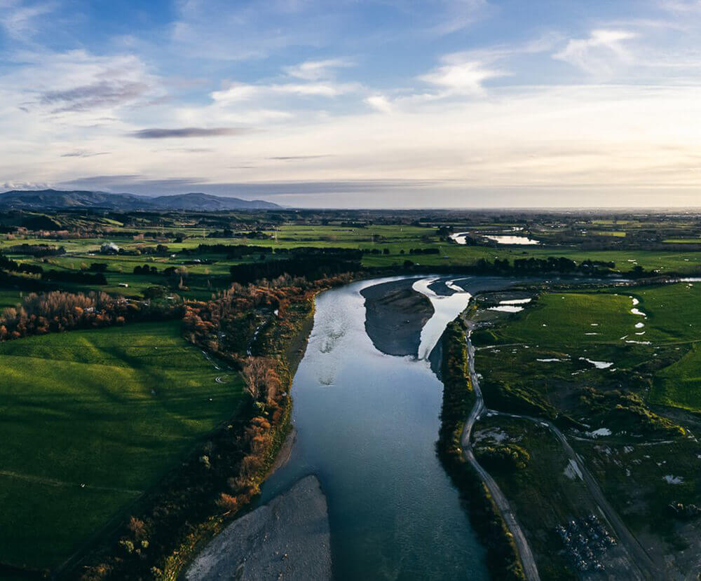
He Ara Kotahi is Palmerston North's newest riverside pathway, connecting the city with Linton Military Camp, Massey University and FoodHQ. The pathway was officially opened in June and as it winds its way along the river it provides breathtaking views of the river and city, before leading you through farmland, native bush and pa sites.
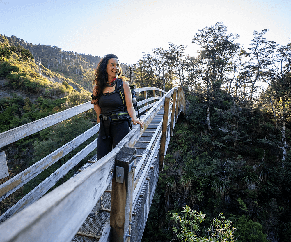
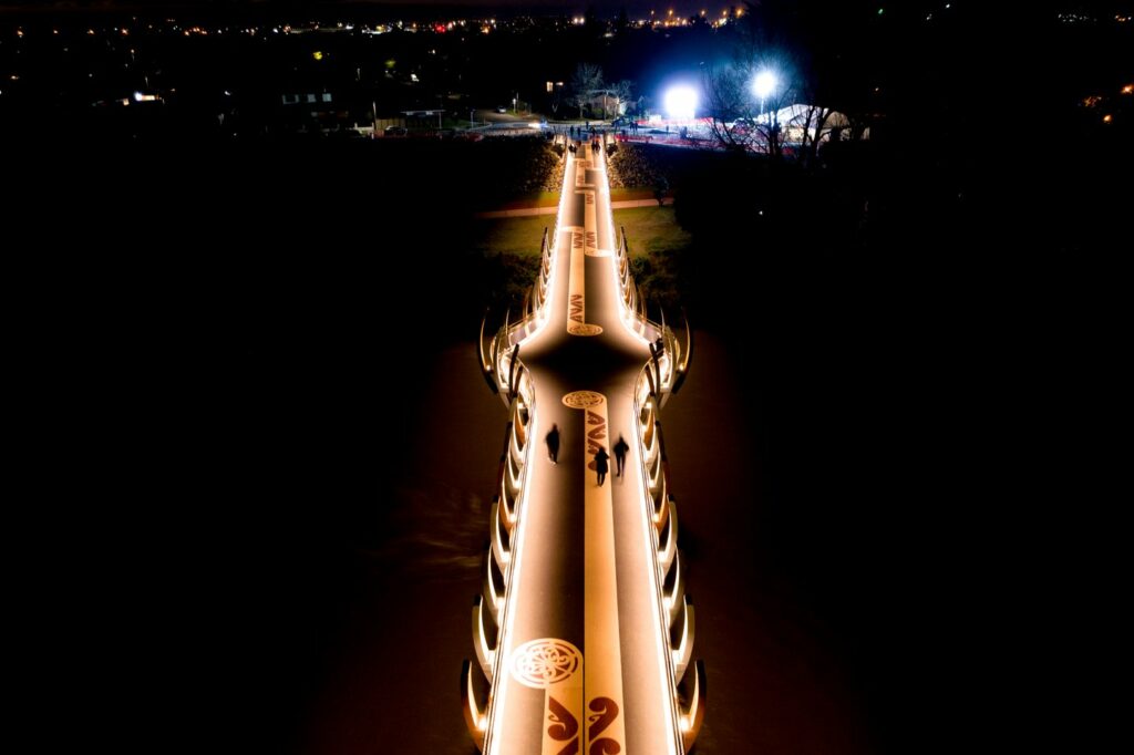
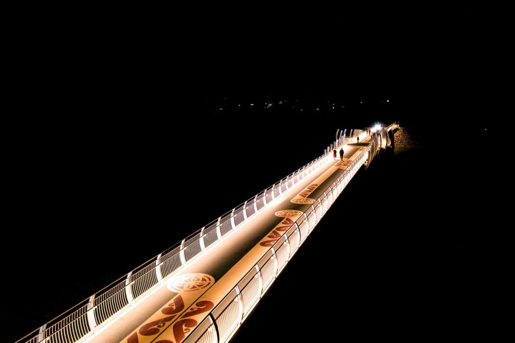
The star attraction of the walkway is the 194m long He Ara Kotahi Bridge, connecting Victoria Esplanade with the other side of the river. From the sky, the bridge looks like a fallen Karaka tree with its roots on the southern bank and its trunk spanning the waterway and its branches and canopy on the northern bank. At night, the bridge is lit up by 'stars' (luminous spheres) that have been sown into the bridge, and soft lighting lines the bridge, creating a feeling of the bridge floating above the river.
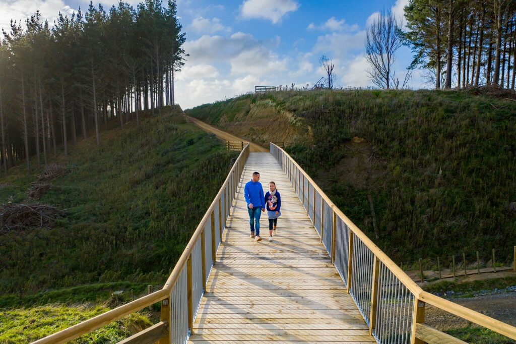
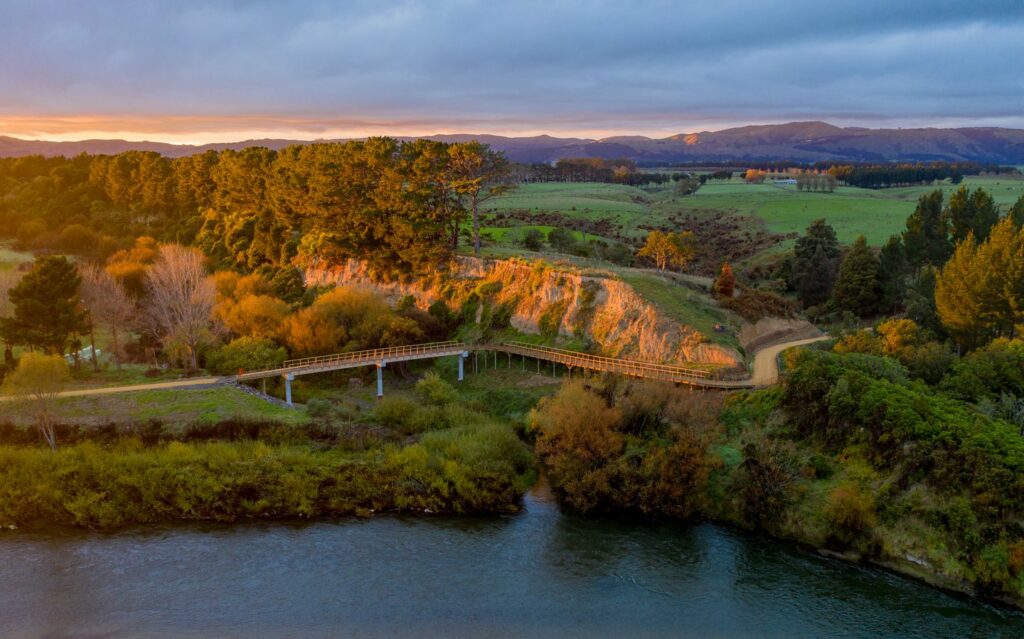
The pathway has four other bridges on the route out to Linton, including a suspension bridge that resembles the Golden Gate Bridge in San Francisco.
To access the pathway, there are four entrances:
You can choose how long you want to walk or cycle with a range of different length tracks, but remember, the track isn't a loop and you will need to come back the way you came.
Distances:
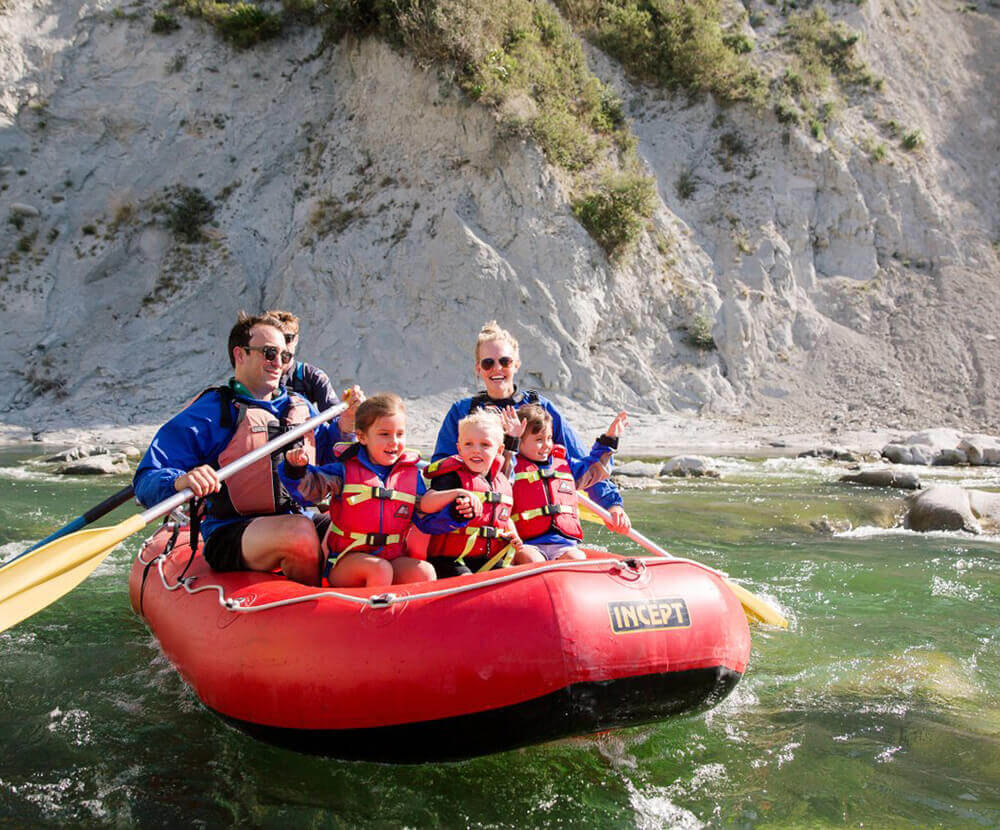
He Ara Kotahi links up with the Manawatū River Pathway, which is a 9.8km walking and cycling pathway that follows the Manawatū River. For a longer walk, run or cycle you can combine the two pathways
Stick to the trail and respect the environment by making sure the only thing you leave behind are footprints. The weather can change in an instant. Make sure you plan ahead and take the right clothing and adequate food, water and supplies. Check out these gear lists for walks and hikes.


Level One
5 Broadway Ave, Palmerston North
PO Box 12005
Palmerston North 4444
+64 6 350 1830
[email protected]
CEDA.nz
Palmerston North City i-SITE
The Square, Palmerston North
0800 MANAWATU
(626 292)
[email protected]
Feilding and District
Information Centre
Feilding Railway Station
61 Aorangi Street
+64 6 323 3318
[email protected]

Tap  on anything you like to add/remove it from My Trip. Then download so you can print or share your upcoming trip to Manawatū. Explore Now >
You can drag and drop activities to reorder them.


